41
Dodona and its Origin.
TRAVELS IN EPIRUS AND ALBANIA
CHAPTER VII.
Dodona. Valley and Strait of the River Aous, now the Voioussa.
Valley of the Celydnus. Tebelen. Argyro-castron.
The confirmation of my appointment being received from Constantinople, and the necessary ceremonies for my installation being performed, I was removed from my situation in the castle, to my own residence in Janina. There, as my headquarters, I passed ten of my best years, in the midst of vicissitudes and dangers, of which none but those who have had the occasion, the misfortune I may well say, to be connected with Aly, Pasha of Janina, or to live under his authority, can form any conception. As soon as propriety and the fear of exciting suspicion of my purposes would allow me, I entered on my projected series of tours, to various quarters of the highly interesting countries, in the centre of which it was my lot to be placed. Postponing therefore, for the present, my observations on Janina and its immediate vicinity, I shall enter on my tour through the great vallies of the Aous and the Celydnus, commencing with some conjectures relative to the position of the celebrated antique Dodona, which I am inclined to place on the southern slopes of the lofty mountains which inclose the lake and valley of Janina on the north.
![]()
41
Dodona and its Origin.
To explain the fable of the oracular doves and cauldrons of Dodona,
is not my present business: it is enough for me to know that the scene
of these fables did actually exist amidst the mountains and forests with
which the lake of Janina is surrounded. The country of Molossis, before
it acquired that name from the son of Neoptolemus and Andromache, was called
Adonia and Pyrrhias. Bounded on the north by the country of the Atintanes,
on the east by Perrhæbia, on the south by Cassiopaæia, it was
so closely connected on the west with Thesprotia as to be often confounded
with that country. Hence geographers ascribe Dodona sometimes to the Molossians,
sometimes to the Thesprotians: by Æschylus, Dodona itself is placed
in the Molossian territory, yet the temple of Jupiter at Dodona is said
to be Thesprotian. As to the name Dodona of the Romans, or Dodonè
of the Greeks, the latter people, in the fecundity of their imagination,
derived it from at nymph or daughter of old Ocean; Others referred it to
a river, of which neither the source, nor the course, nor the country,
did they attempt to determine. In this uncertainty, the fancy of Palmerius
(Græcia Antiq. ii. 8.) is just as plausible as any other. He supposes
the name to hare been suggested by the sound of the brazen vessel when
struck. From ![]() ,
Do Do might easily be formed Dodonè. Had the learned Palmerius heard
the sound, and beheld the shape of the gong of the Chinese, and witnessed
the excitement of its voice, his conjecture would have been strongly confirmed.
,
Do Do might easily be formed Dodonè. Had the learned Palmerius heard
the sound, and beheld the shape of the gong of the Chinese, and witnessed
the excitement of its voice, his conjecture would have been strongly confirmed.
It is known that the oracle of Jupiter existed in Epirus prior to the deluge in the time of Deucalion, with a temple erected by the Pelasgians, that is, by the earliest inhabitants of Greece, who passed into that country from beyond the seas.
"O Jove, Pelasgian Jove, Dodona's king!
Whose temple winter's killing frosts invest;
Around thy fane thy Sellian priests abide,
Who sleep not on the ground, nor lave their limbs."
Thus speaks Achilles himself, a Thessalian of Larissa, who may have
personally consulted the oracle. Iliad, xvi. 233, &c.
The temple was erected on Mount Tomoros, in a district called by Hesiod Hellopia, that is, the land of lakes. The temple itself, like those of Actium, Delphi, and Olympia, was merely a hieron, or sacred inclosure, open above, and surrounded by a grove, if not by a forest of oaks. Having consulted the ancient authorities, and the most respectable commentators and geographers on the subject, my residence in Janina, and my surveys of the environs, led me to conceive the valley of Janina to be the true land of lakes, the Hellopia
![]()
42
of the ancients. For it is the only district in Epirus which correctly corresponds to the descriptions of that region.
The valley of Janina forms a plain of eight leagues in length, from north to south, on a medium breadth of two leagues, and is inclosed by mountains on every side. Pindus rises up in three stages on the east, of which the least elevated, called Mitchikeli, borders the plain on the east, and north. On the west and south, the hills are neither so lofty nor so abrupt. The higher summits and ridges which inclose the valley, give it the air of a parterre enamelled with flowers and verdure in a frame of frost and snow; of snow which never completely disappears until the greatest heats of summer arrive.
In going out of Janina by the gate of St. Nicholas, at the north ead of the city, that by which I entered, you proceed over a plain between cultivated eminences on the west, and low pastures and a marsh on the east. Nearly three miles northward you come to the caravanserail of Khanopoulo; and a little farther on the right is the church of St. John Palæo-Lavrita. On the opposite side of the marsh are seen Strongia, the monastery of St. John Lycotrichi, and the village of Vragnia, along the foot of Mount Mitchikeli, surrounded with corn and vines.
Turning north-westward about two miles you ascend a cultivated slope to the monastery of Paraskevi of the images. Within the inclosure of this building, planted with cherry-trees, is a large stone sepulchre, bearing the epitaph in Greek of an obscure person, named Nearchus. From thence, continuing to rise up by the side of a torrent, you come on the highest summit of the southern portion of the mountain of Gardiki, which is completely surrounded by an inclosing work of what is styled Pelasgic, or Cyclopian, that is, of the very earliest structure, composed of vast blocks of rude stone, which preserve their position by their proper mass and weight, unconnected by any cement or mortar. This inclosure evidently appears to have been an acropolis or citadel on a summit, as the term imports, of the most remote antiquity. The rampart and the towers, or the buttresses (for the solid projections may have answered both purposes) are formed of irregular polygonal masses of rock, fitted the one to the other; but the exterior part is merely blocked out, and nearly in the state in which it was raised from the quarry. Such is the rampart, which has but one entrance open to the north. Within the inclosure, among the ruins of several buildings, is a tumulus, sixty feet square, sustained by a wall faced with rough stones, to the eastward of which is a hollow with vestiges of
![]()
43
Description of Dodona.
comparatively modern work. Going down into this place by a double stair, you come to two wells, of which one still affords water. The tumulus or elevated spot is, in my opinion, the hieron or open rustic temple, erected to Jupiter of Dodona. That such places of adoration, and in such situations, were formed in the earliest epochs of the world, is well known. The high-places of the sacred Scriptures were precisely of this description. The ruins within the inclosure, and around the tumulus or hieron, may perhaps be the remains of the habitations of the Sellian priests. The wells must have been necessary for the occupiers of the place at all times. Such, in my conception, has been the Cyclopian work of Gardiki, the temple of Jupiter Dodonæan, and the abode of the Sellians, visited by Herodotus nearly twenty-three centuries ago, when the wonderful prophetic oak no longer existed. That a temple of regular architecture was afterwards erected to Jupiter at Dodona, is evident from what is said by Polybius, in his Fourth Book, concerning the operations of Dorymachus. That "when be arrived at the temple of Dodona he burnt the porticoes, destroyed or carried away many of the sacred offerings, and threw down the holy edifice itself." As the porticoes and their columns were burnt, they were perhaps of wood: and it is remarkable, that within the inclosure, in the midst of so many ruins, not the smallest morsel of marble has ever been found. It must also be added, that the persons who labour the ground within the rampart have never discovered an ancient coin or medal of any sort.
According to my survey of the supposed Dodona, on the hill of Gardiki, the rampart forms an irregular rhomboid, of which the long sides are, on a medium, 380 yards, or nearly a quarter of an English mile from north-west to south-east, and the short sides one half of that space. The inclosed area is therefore about fifteen acres. On the south-side the rampart runs along the brow of an inaccessible precipice: on the east and west sides the ascent is less abrupt, and at the north-east corner a winding path leads up to the entrance, the rise to which is facilitated by a ramp thirty-three feet in length, of the same construction with the rampart. The tumulus and hieron are placed opposite to the entrance, towards the northeast corner of the inclosure. The most entire part of the rampart reaches from the entrance along the east and south sides, nearly to the south-west corner. On the east side are foundations of three towers or buttresses, and on the south side of one.
Pursuing my route northwards, froin Gardiki or Dodona, across the mountamis, I entered the district of Zagori, so called
![]()
44
by the Sclavonians, who regarded its position behind or beyond the mountains, which is the import of the term. From Homer we learn that among the tribes who furnished warriors against Troy, were the Peræbi, who dwelt in the neighbourhood of the wintry Dodona: they must, therefore, have occupied the mountainous Zagori. The country is separated from the vale of Janina by Mount Mitchikeli on the west, and by the chain of Mounts Lazaris and Panesti, from the district of Conitza on the north. The loftiest summits of Pindus separate it from Macedonia on the north-east. The course of the In-chus, the river of Arta, is its limit on the south.
The last rays of the sun enlivened the rugged western sides of Mitchikeli
when we attained the fountain of Skiapoto, situated in the upper region
of that mountain; and we closed our day's journey at Dovra, a village only
four leagues north-north-east from Janina. The position of this village
is perhaps unique: for it occupies the interior of a crater, surrounded
by four summits, and into which you enter by a narrow gap. In the centre
is a well, lined with antique masonry. Among a number of coins sold to
me in the village was one bearing a thunderbolt within an oaken garland,
and the word ![]() :
on the reverse, a pine-fruit. Whether these types may indicate the temple
of the Thunderer amidst the oaks and pines of the Molossian mountains,
may be a question: but the coin is the first written memorial of the existence
of that people in this quarter. The old castle, as it is called, of Dovra,
is of Cyclopian structure: but what town it represents I know not. By excavations
coins might perhaps appear within the rampart; but not one inscription
have I ever seen or known to be found within an inclosure of that sort.
Inscriptions are of a much later date. As we entered the crater of Dovra
by a sort of embrasure or gap between rocks, so we made our way out of
it next morning by a similar aperture sixty feet wide. Continuing to advance
towards the summit of the ridges which separate the vale of Janina from
the valley of the Voioussa on the north-east, we discovered to the right
that portion of Zagori which is watered by the Inachus on the east of Mount
Mitchikeli, to the extent of six leagues, and well inhabited. Of those
villages the most remarkable is Liaskovo, the school, the hot-bed of those
empirics who, under the Greek name calo-iatri (good physicians) dispute
with the medical practitioners of the island of Cefalonia for the business
of all Turkey. Of the Cefalonians some certainly study their profession
in the most celebrated universities of Europe: but the Zagorites of Liaskovo
learn by tradition from their fathers and masters. Yet notwithstand-
:
on the reverse, a pine-fruit. Whether these types may indicate the temple
of the Thunderer amidst the oaks and pines of the Molossian mountains,
may be a question: but the coin is the first written memorial of the existence
of that people in this quarter. The old castle, as it is called, of Dovra,
is of Cyclopian structure: but what town it represents I know not. By excavations
coins might perhaps appear within the rampart; but not one inscription
have I ever seen or known to be found within an inclosure of that sort.
Inscriptions are of a much later date. As we entered the crater of Dovra
by a sort of embrasure or gap between rocks, so we made our way out of
it next morning by a similar aperture sixty feet wide. Continuing to advance
towards the summit of the ridges which separate the vale of Janina from
the valley of the Voioussa on the north-east, we discovered to the right
that portion of Zagori which is watered by the Inachus on the east of Mount
Mitchikeli, to the extent of six leagues, and well inhabited. Of those
villages the most remarkable is Liaskovo, the school, the hot-bed of those
empirics who, under the Greek name calo-iatri (good physicians) dispute
with the medical practitioners of the island of Cefalonia for the business
of all Turkey. Of the Cefalonians some certainly study their profession
in the most celebrated universities of Europe: but the Zagorites of Liaskovo
learn by tradition from their fathers and masters. Yet notwithstand-
![]()
45
Mount Panesti and the River Voido-Mati.
ing this strange mode of instruction, which perhaps is more nearly allied to the practice of the ancient medical school of Greece than we are aware of, it is next to incredible with what success these practitioners operate in certain cases on their patients. They excel, for instance, in the cure of the strangulated hernia; and whatever remuneration they are to receive for their services, they always stipulate for the part taken off, which they inflate and display at the end of a reed as at once a mark of their profession, and a proof of their success. Their services in this malady are unfortunately but too often in request in a country where the truss is scarcely known. Some Liaskovites even operate in lithotomy and the ocular cataract. Another village in these mountains, Djonkli, furnishes the race of bakers throughout Epirus, and to many parts of Romelia.
Continuing still northward our course across the mountains, we arrived at the summit of Mount Panesti, the limit between the districts of Zagori and Conitza, from which the eye penetrates into the deep gulf of Archista and the gloomy precipices of granite which inclose it on the south. Here we found it necessary to descend the steeps on foot, and after half an hour we reached that village, situated amidst broken ground insulated by torrents, but surrounded by orchards. Such, however, is the position of the place, that for several months in winter the inhabitants never see the face of the sun. Beyond this singular place we came to the Voido-Mati, a considerable stream which issues in full vigour from a cavern in the granite rocks of Zagori. It is crossed by a Gothic arch forty feet in width and thirty feet in height from the water, probably of the age of the imperial family of Comnenus. The heat of the day was now oppressive, and our caravan took the opportunity of the shady plane-trees of Voido-Mati to refresh ourselves and our horses. Sitting down therefore by the side of the river I was delighted and amazed by the multiplied music of the nightingales, who, finding in the deep gloom of the grove the shade and the silence of night, gave way to their natural melancholy song. From this spot our route lay along the side of Mount Lazaris on to Conitza. When we had proceeded a mile we came to the huts of Chelidonia, the temporary residence of the harvest-people, whose village is perched among the precipices of the mountain. The country was how well cultivated; for the soil was fertile, and the peasants were not yet so severely oppressed as those in some other quarters of Aly's dominions. Their remote position, difficult of access, had hitherto saved them. Four miles farther towards north-east, we passed through Goritza, a tchiftlik
![]()
46
or estate of Aly, beyond which, nearly two miles, we passed a limpid stream on its way to the Aous, or Voioussa, of which I began to discover the whitish waters. The base of Mount Lazaris, covered with wood, to which we were approaching, brought us to a branch of that great river. Following its left bank we came to Amari, a poor village, but noted for a spring of excellent water. Here we were obliged to climb up the side of the mountain, almost perpendicularly over the Voioussa, then dragging along floats of squared timber, destined for the construction of palaces erecting by Aly, at Premiti and Tebelen. This dangerous route conducted us for two miles to the bridge of Conitza, thrust in between the abrupt extremities of two hills. From between these hills the river bursts forth with a loud noise, to spread through the plain of which we bad followed the southern side, all the way from the bridge of Voido-Mati. Eight minutes more led us up to the town of Conitza, where I was lodged in the house of the Codja-Bashi, or magistrate, who was prepared to expect me.
The river Voioussa, or the Aous of antiquity, which is crossed by a
bridge before you go up to Conitza, rises in the mountains above Metzovo,
where the road from Janitia leads over Mount Pindus into Thessaly. The
source of the Aous is there pointed out by the peasants in a plentiful
spring, in the midst of hillocks, consisting of blackish sand. Strabo says
(VII. 316.) that the Aous rises in the same mountain with the Inachus;
as is in fact the case: for the former springs out of the western side
of Mount Politzi, and the Inachus out of the eastern side of the same mountain.
On issuing from its urn the Voioussa forms a stream similar to that of
the Doria when it issues from the lake on Mount Cenis, on the road from
Chambery to Turin; and trouts abound in the Pindan, as in the Alpine river.
But the waters from the spring are soon augmented by two other streams
from the same quarter. The Aous is afterwards much increased by several
collateral streams, before it enters the upper part of the ![]() ,
or straits of the Aous. These narrow straits have been so variously situated
by different writers, that modern geographers have been unable to assign
to them any fixed position. Nothing therefore but a personal examination
of that river, and of the country through which it pursues its course,
can determine the disputes concerning the straits. Nor are either ancients
or moderns agreed concerning the proper names of the river. Of the former,
however, Aous, and of the latter Voioussa, are the most correct, and originally
the same.
,
or straits of the Aous. These narrow straits have been so variously situated
by different writers, that modern geographers have been unable to assign
to them any fixed position. Nothing therefore but a personal examination
of that river, and of the country through which it pursues its course,
can determine the disputes concerning the straits. Nor are either ancients
or moderns agreed concerning the proper names of the river. Of the former,
however, Aous, and of the latter Voioussa, are the most correct, and originally
the same.
Conitza, or Gonitza, represents one of the cities of ancient
![]()
47
Conitza, and the Valley of the Aous.
Epirus; so, at least, may be supposed by the Pelasgic acropolis, placed on the west slope of Mount Konis, perpendicularly over the right or north bank of the Voioussa, and commanding the passage over the river. But what was its antique name is unknown. It may however be the town called Glabinitza, by Anna Comnena. The termination itza, used by the Sclavouians, is said to denote the position of a town in some narrow pass or defile. Such a position is termed by the modern Greeks Steno-choria, and by the Turks Derven-casabas. The present town of Conitza, for the acropolis is wholly deserted, rises up in steps or stages on the western side of the hills, and contain 600 houses, the larger half occupied by Mahometans, with two mosques and an equal number of Greek churches. It is a bishop's see, and has been selected by Aly, as the final residence of the retired ladies of his family. Like the other towns of the Turkish dominions, Conitza is noticeable only for the irregularity of its buildings, and for the awkwardness of its narrow crooked dirty streets. The schoolmaster and the salaried physician of the place, my spontaneous guides, judged of Conitza much more favourably. For independently of its antiquity, which they carried back to Antigonus Gonatas of Macedon, they expatiated largely on the beauty of its situation, unmatched in that quarter of Epirus. The physician however, a native of Zante, who had been a surgeon on-board a Venetian galley, hinted to me in confidence that the air of Conitza was most unwholesome, the water very bad, and the Turkish inhabitants of the very worst description, until Aly, by becoming master of the town, had brought them under his exemplary discipline. The chief cause of the bad air of Conitza is the mud deposited and left by the Aous, when the waters, after they inundate the low grounds, return into their proper channel in summer. I was nevertheless inclined to attribute no small portion of the disorders among the Conitzians, to the repeated bleedings he prescribed, to promote the custom of a barber-surgeon in the town, in whose profits he had a share.
From Conitza, I could view the valley of the Aous, winding through it from south-east to north-west, on to the narrow pass of Caramouratades, a distance of four leagues. In the valley I could see a teke, or convent of howling dervishes, or Mahometan monks, who persuade themselves (or would persuade others,) that heaven is to be propitiated by screams and contorsions. I observed the influx of the Topolissa, which rising in Mount Sousnifza, flows east then north, and at last west to the Voioussa. At that extremity of the valley, the hills which incline to the west, with wooded slopes, present a number of
![]()
48
villages on an extent of three leagues. On the descent of the hills of Voido-Mati, I saw the village of that name, and also Skia, intermingled with trees in a bottom presenting a beautiful object, when illuminated by the declining sun. The sunny valley inclosed by the snowy summits of Mertchika and the Candavian mountains, had a singular effect; and eastward the eye could penetrate into the vallies which lead into Macedonia. To the south shot up the peak of Kamila, in the country of Zagori, brilliant through its snows above all the other summits of Pindus. Near this peak are two vast glaciers, on the borders of which is situated the monastery of Stomio. The contrast between the dreary winter of the frame, and the flowery summer of the valley of the picture, was particularly striking: yet this view was beheld only in the beginning of April.
Having observed the environs of Conitza, I employed myself some time in determining its position with relation to Janina; a matter of importance for the topography of the country, particularly as Conitza has been erroneously placed by Gaetano Palma, in his map published in Triest in 1811. Yet his draught was sketched out under my directions in Janina. In that map, Palma lays down Conitza forty-six miles north from Janina; and he removes the course of the Voioussa thirty miles to the southward, and nearly twenty miles to the westward of Conitza, making the river describe a bend of great extent. From the particulars of my journey, it will be evident that some strange alteration in that quarter must have been made in his map. For, from the most correct observations applied to a map, it results, that the distance between the two towns, deduction being made for the indirect course of the roads, is only thirty-two miles and-one-third. Again, Conitza, instead of bearing due-north from Janina, bears between north-east and east-north-east: or about north 68 deg. east by the compass. Lastly, the Voioussa, which Palma removes to a great distance, making it describe a large imaginary curve, actually, in issuing from the rocks of the district of Zagori, washes the base of Mount Himnadi, and the lower part of the town of Conitza itself: from which point the river pursues a course north-west, to the entrance of the famous strait of Pyrrhus, now of Caramoutades. From these mistakes it follows that Metzovo, near the great pass over Mount Pindus, on the way between Janina and Larissa, is also wrongly placed by Palma; thus rendering the interior of his map extremely erroneous.
In order to determine the topography of tlio eastern parts of the district of Conitaa, I ascended the Mount Himnadi for
![]()
49
Mount Caulonias. Zelitza.
half a league, to a chapel of the Virgin, near which are several very abundant springs. This pass across the mountains was oace a chosen post for robbers: but Aly Pasha has completely subdued the lawless dispositions of the inhabitants of Mount Caulonias in that direction. Now this spot serves to conceal the hunters, in winter when the snow covers the mountains, employed in shooting the bears and wild-boars driven by hunger down into the vallies. Proceeding north-east by a breach in the sweep of the mountains, I attained the chapel of St. Anastasius, erected in the heart of a thick wood of gall-oak. There I had a distinct prospect of the general course of the great rivers in different directions. To the southward I had the three summits of Mount Himnadi, of which that on the east called Helia, is itself commanded by that which gives name to the range of mountains, crowned on the west by Mount Konis, almost constantly involved in snow. The white summits contrast strikingly with the deep tracts of pine-forest which cover the middle region; and this last with the red rocks at the base, which confine the right or north bank of the Voioussa. From the sides of this mountain are washed down by the rains those masses of rock-crystal found in abundance even at the gates of Conitza. Having determined a number of positions, of great service in forming the plan of the country, I descended from the chapel of St. Anastasius for three quarters of an hour, to the bottom of the valley of Piklari, inclosed on the west by the mountains of Conitza, and on the north and east, at the distance of three leagues, by a continuation of the curving chain of Sousnitza. Thence going beyond the springs of the Topolissa, at the end of two leagues east-south-east I reached Zelitza, a village on the slope of Sousnitza; and higher up I saw Vranista. In this course I observed a stream bending to the north, to fall into the river of Saranta Poros.
I was now in a region of special interest for the historian: for by it must have passed the Roman armies employed against the latter kings of Macedon; particularly that under Quintus Flamininus, in pursuit of Philip in his flight to Mount Lingos. Across the same country, but by very different routes, marched the contending- armies of the great rivals Cæsar and Pompey, from Dyrrachium to Pharsalus. But in the present day, I should only have to describe a country desert and wild, where the name Roman indicates the enchained Greeks, who adopted it when Constantine transplanted to the banks of the Bosphorus of Thrace, the eagles, the purple, the high honours, but not the fortune of Rome. Among the summits of the Central range of the mountains, dividing Epirus from Macedonia,
![]()
50
springs up Smolika, a peak so elevated, that from it, according to the people of the environs, may be seen the Adriatic, and even the island of Corfu. In my opinion, however, this must be a mistake or a fable: for independently of the projection of Mount Mertchika, which bounds the horizon to the westward, the distance of Corfu is too great to allow it to be discovered by the eye. In Strabo, (vii. 313.) we read, that, "Mount Hæmus extends towards Pontus, the greatest and the loftiest range of mountains in those parts, for it divides Thrace in the middle. From this range, as Polybius says, the sea may be seen on both sides. But in this he says what is not true: for the distance to the Adriatic is too great, and many objects intercept the view." Had Strabo considered, that, under the name Hæmus, the great central range, extending between Macedonia and Epirus, and even Pindus itself, were comprehended; (by Lucan, even the field of Pharsalus is placed under Hæmus,) he would perhaps have been less ready to controvert the assertion of such a man as Polybius, who probably spoke from report and not from personal knowledge. Molitza four leagues north-east from Piklari, Staritachiani one league east-south-east, and Kerasovo, are the only noticeable villages in the valley of Saranta Poros, which rises above the last place five leagues from Conitza. Soon after its issue from the Haliacmon range, (still called by the Greeks Ora-Liaka,) the river runs first north two and-a-half leagues, then west six miles, and lastly north-west to the Voioussa. All that mountainous region, as well as the solitary valley of the Saranta Poros, abounds in springs and rivulets; agriculture might there consequently flourish: but hands are wanting. The laboured lands are far asunder, and in one day's journey I met but ten persons on the different routes I followed. The peasants fled on the approach of our wandering caravan; and those Mahometan Albanians whom I did meet, were not in a humour to gratify my curiosity. Retiring towards Kerasovo, to pass the heat of the day, as I was engaged in making enquiries among the peasants, my guides began to suspect my intentions. They murmured at my asking the name of the hills, villages, &c. around, especially at my drawing mysterious lines on paper with a pen only without ink, (my pencil.) Fortunately, however, the chief guide, an aga of Tebelen, pacified them, but desired me privately to be more guarded in my perquisitions, and not, as he termed it, to write down the country. Hard as this advice was upon me, I complied witli it, and we advanced to Chioniadez, where we put up for the night.
At every step we made into Illyricum, the traces of civili-
![]()
51
Smolika. San Marina. Barmachi.
sation become less and less perceptible. After I left Conitza, I heard no more Greek spoken in the villages, so that my inquiries were conducted through an interpreter, neither very able, nor perhaps very willing to favour my views: my next resource therefore was, to advance to the head of our caravan, and, by means of a present, to procure the help of our postilions, who were Greeks and well acquainted with the country. From them I collected the names of many villages, mountains, rivers, &c. which I was afterwards enabled to correct from other information. Our route led up one-third of the height of Mount Smolika, from whence I could observe the populous village of San-Marina, a colony of Walachians, consisting of 800 families: it bore then from me north-east five leagues.. The flocks and herds were now beginning to ascend towards the pastures, in proportion as the snow melted on the lofty fields of Mount Graminos, on the limits of Macedonia. The merchants were preparing to proceed to the fairs, which are held when the shepherds return to their summer dwellings in the upper regions. Along with the merchants went many persons in easy circumstances, to pass the season in a succession of amusements of the more tranquil sort, the delight and often the business of the generality of the orientals.
The district of Caulonias, to which 1 was approaching, might be considered as the key-stone of anarch of lofty mountains, which separate Epirus from Macedonian Illyricum; dividing the waters which fall into the Aous on the south, from those which direct their course to the Apsus on the north. When I arrived in Janina, it was my intention to follow the great central range of mountains northwards to Ochrida on the lake of Lychnidus. Aly, however, opposed so many difficulties to my project, and artfully suggested so many good reasons for so doing, that my project was laid aside. His true reason however was, that, as the French troops were then in the northern parts of Illyricum, he suspected my tour was intended to procure information, respecting a passage over that tract, to enable them to penetrate into his dominions. Being now on the borders of Caulonias, I could not resist the desire to obtain a general view, at least of that mountainous region. I had before conversed with people of that quarter; and although the inhabitants were Albanians, little removed from a state of barbarism, yet I succeeded in persuading my guides that we should be well received. By these means, and a few presents distributed among them, my object was attained. Proceeding accordingly from Podez of the district of Conitza, in an hour and-a-half we arrived at Barmachi, the first Caulonian village, situated in a valley in-
![]()
52
habited by 300 families, Christian and Mahometan, alike independent in their mode of life, and barbaric in their manners. The village is situated on the road followed by the traders from Janina to Ochrida, and is commonly their third station. The first day's march conducts the cararan from Janina to Ravenia, eight hours to Lexovico, seven hours and-a-half; to Barmachi, five hours and-a-half. Along the valley which stretches west-north-west sixteen miles, runs the Levkaritza, which falls into the Aous; having its springs three and-a-half leagues to the east in Mount Barcetesios, mentioned by Ptolemy under the same name. Every thing hitherto favoured my scheme; and having surmounted the chain of Barcetesios on the north, we entered a second valley called by the Albanians Eriboé, and by the Greeks Ribas. A little way from our route I observed the remains of a Cyclopian inclosure or rampart, which suggested to me that it might belong to Eriboia, a city placed by Ptolemy among the Parthinians. The river, also called Eribea, rises, as I was told, among the higher mountains, and falls into the Aous near the bridge of Cleisoura, or the straits to be afterwards mentioned. The Apsus, as I learned in the country, is there called the Ergent or Argent, and not only below the bridge where it is crossed in the road from Apollonia to Berat. This river, which descends from the Candavian or Caulonian mountains, after a course of three miles passes below Helmas, a village on its right bank; and a league lower down meets with the Ossouni, which rises five leagues north-east, in Mount Slobokoé, the most elevated summit of the mountains of Deabolis now Devol. The united stream then traverses the district of Tomoritza, where still exists Myli, a fortress in which the Emperor Cantacuzenus besieged the Normans. Leaving the country of Tomoritza, the Apsus passes through the lower town of Berat, and increased by another stream from Moschopolis, in the same Candavian mountains, it traverses the country of Musachia, under the names Beratino and Cauloni, to be lost in the Adriatic, five leagues to the northward of the ruins of Apollonia. While we were at dinner I observed my guides and guards in close conversation in the Albanian language, which I did not understand; and as soon as we were again on our route, they informed me, that, from what they knew of the inhabitants of the country before them, they were determined to advance no farther in that direction; for that my presence could not fail to create alarm in the minds of a race so rude and inhospitable. With the greatest reluctancy, I was constrained to relinquish the examination of a region the least known probably of Grecian lllyricum. Two leagues east from Staria, as I was told,
![]()
53
Situation and Population of Caulonias.
near the villsge of Codras, is Veré-Toubae or the cave of the tombs; and in the vicinity are the remains probably of Codrium, a town mentioned by Livy, (xxxi. 27). The cave, it was said, was full of little cells and tombs cut in the rock; and at the entrance are two colossal lions carved in the stone. I was now in front of a valley, which would have conducted me straight to Premiti on the Voioussa: but our baggage having been left in Conitza, I returned by Verbiani in the valley of Sarauta Poros, and arrived, after a tour of seven very fatiguing days, at the place where the tour began. Severely mortifying as my expedition had been, I collected some useful topographic notices. From Staria a to Gheortcha, the distance is reckoned six and-a-half leagues, and four from the latter town to Podgorie; thence three hours' journey to Starova; in all eighteen hours from Staria to the town of Ochrida. The population of the country of Caulonias is estimated at 6,400 persons, Christians and Mahometans, occupying twenty villages. Whether Mahometan or Christian the Albanians of that tract are equally independent and unruly. They pay neither capitation nor any other tax; nominally they acknowledge the authority of the Pasha of Berat; and by their bravery and their poverty they have hitherto escaped subjection to Aly of Janina. He has never, it is true, seriously attempted to subdue the Cauloniates; for among them he is sure always to find bands of robbers and assassins, ready for money to issue from their mountain-passes, to drive off the governors or other officers of the grand-seignior, who presume to approach too near to his dominions. From this state of things, however, this advantage arises, that a person under Aly's special protection might securely visit the Barcetesian mountains, the country of Devol, (Deabolis of the Byzantine writers,) the springs of the Apsus and the cave of the tombs. A region ten leagues in extent from south to north, would thus be laid open to the antiquary and the geographer; nor, were I to judge from some specimens which came within my observation, would the mineralogist and the botanist have reason to regret the time employed in the research. The occupation of Caulonias, for a pasha master of Epirus, for a pasha like Aly, is of the utmost importance, on account of its relation to Monastir, the capital and chief residence of the Romeli-Valessi or governor of Macedonia. Caulonias is also the central point of the intercourse between Janina, Ochrida, and the upper and lower Dibra. When the snows of winter block up the pass over Mount Pindus above Mezzovo, the vallies and passes of Caulonias, less elevated, are practicable, and become the common route of couriers for Constantinople.
![]()
54
Being less observed than the other routes across the mountains, it was by those of Caulonias that, during the time of my sufferings under Aly, I was able to carry on correspondence with Constantinople and other parts; and while Moschopolis subsisted, through Caulonias was opened the commercial intercourse with the northern parts of Albania, &c.
Often as the Aous is mentioned by the ancients, not one has traced its course; contenting themselves with indicating its springs in Mount Pindus, and its opening into the sea below Apollonia. Plutarch, for instance, tells us, in his life of the Consul Flamininus, that "the Aous, equal to the Peneus of Thessaly in magnitude and rapidity, flows through a deep and spacious valley, inclosed on both sides by great and lofty mountains." Departing a second time from Conitza we crossed the muddy bed of the Topolissa, and at an hour's distance we passed under Koutchouf. Halting for dinner under a group of oaks to the southward of Sanovo, I made observations on the bearings of various objects around me, by means of the compass, calculating as carefully as I could its variation, and then travelled down the Aous, to a stone-bridge of four arches across the stream, a little below the influx of the Voido-Mati, formerly mentioned. Then bearing northwards we entered the Stena (straits) in which we proceeded a mile to the village Melisso Petra, which is the limit of the districts of Conitza and Sesarates, as it is called by the Greeks, or Caramourataclez, as it is termed by the Albanians. On the opposite side of the Aous, a mile off, I saw Ostanitza, and the ruins of Pogoniani, a town restored, as it is said, by John Palæologus, on the site of Appo. Near our position was a tower, constructed for the defence of the narrow strait along the river. Two miles north from Melisso-Petra, along the margin of the stream, we came to an aqueduct for supplying several mills; and very soon afterwards we saw a bridge over the Aous on the road from Janina to Upper Albania, a little above the influx of the river Saranta-Poros, up the left bank of which we travelled to a bridge on the routes by Lexovico and Caulonias to Ochrida, and down the Aous, through the straits of Perseus into Musachia. By the number of bridges still remaining in this secluded quarter of Albania, we may form some notion of the communication and population of the country in former and better times. The mountains on the west side of the Aous here take the name of Mertchika; their upper parts, clothed with pines, commanded by lofty peaks, covered deep in snow; being those same summits which are seen from Janina and Lower Epirus. The first place on the left of the Aous, in the district of Cara-Mouratadez, is Mesa-
![]()
55
Seran. Biovicha. Tcharchof, &c.
reth, or Sesareth, probably the successor of the ancient Sesarethia. Proceeding, we observed several villages on the heights on both sides of the river, which filled in one channel the whole breadth of the strait. We had now ascended the mountain side, and were at a great elevation on a path much exposed in winter to avalanches, such as are so dangerous in the Alps, which not only stop or overwhelm caravans and travellers, but frequently block up the river. Half a league beyond Perati we passed above Seran, a large village; and on the side of Mertchika we saw Biovicha, a place inhabited by Turks and Christians. It occupies two eminences, separated by a deep ravine, which is unable, however, to interrupt the inveterate animosities which agitate two bodies of people, alike governed by ignorance and fanaticism. From our elevated road we proceeded half an hour to a bridge over the Tcharchof, which descends from the glaciers of Mount Chomi, three leagues and a half to the eastward. For three quarters of an hour we were then employed in winding- up, with great labour and difficulty, to a level space, commanding a view of Mounts Panesti, Kamila, Smolica, and the rugged summits of Caulonias.
The village where we halted was alarmed at our appearance; so much so, that it became necessary to exercise authority to obtain a lodging in the house of a Greek priest, the codja-bashi, or magistrate of the place. Although planted with vines, the environs of Tcharchof are deep in snow in winter, and then infested by wolves, who make their way even into the houses. Once a wolf penetrated into the chapel of the place, and devoured the consecrated bread; but the fear of profaning the sanctuary procured for the invader the means of his escape.
Setting out next morning with the sun, we steered northwards, descending to the valley of the Aous, there about three miles in breadth, and thrown into fields of corn, flax, and clover. At the Turkish village Stoiani, the Aous receives a river which is often so swelled by the rains as to compel travellers to mount up a considerable way to cross it. A league beyond this village, on our right, we saw Fourca, (the fork) a place which, from the remaining Latin name, denotes the spot where the road from Lower Epirus breaks off from that laid down in the Peutingerian table, which traverses the mountains of the valley of Saranta-Poros to enter the district of Greveno, in the southern quarter of Macedonia. Not then knowing that any objects of curiosity were to be seen in Fourca, I did not go up to the village: an omission I have since much regretted. There I should have procured a stock
![]()
56
of useful information; for the people of that place were employed in furnishing cattle to supply the Freivch garrison. From what I could observe and learn afterwards of the position of Fourca, it seems to occupy the site called by geographers Castra Pyrrhi, in which the Romans had a strong post. When we had advanced above a league in the plain we crossed by a bridge the river Ardès, and the commander of my escort was questioned by a man keeping sheep, but in full armour, mounted on a horse gallantly equipped, desiring to know who was the infidel he conducted in such state. Soon silenced by my chief, the stranger turned away, spitting and muttering expressions of abhorrence. This personage was an Albanian gentleman, or bey, who, although not in a condition to hire a shepherd, would yet have thought himself degraded had he performed the duty in person without the necessary appendages of his rank, his horse and his arms.
In our progress we came to a bridge of three arches over the Aous, at Petrani, where the road passes over to the west bank, a little above the influx of the Levkaritza, coming down from the mountains to the northward. Continuing our route down the west bank of the Aous, we arrived in Premiti, where a lodging was provided for me. I had scarcely felicitated myself on my entrance once more into the society of men, when I was accosted in French by a venerable man, in a style and manner so unexpected, that it was some time before I could articulate an answer. He had travelled over Europe, and sojourned for years in Paris, where he associated with Diderot and the other eminent men of the last century. "Premiti is my birth-place," said he; "I have frequented the most polished society of the most polished nations; yet a man of sense may be happy in every situation: of this I am myself a proof."
Premiti, on the west bank of the Aous, is altogether a new-town; and the walls, which encompass the summit of a rock over the river, seemed to me to belong to one of the citadels constructed by Justinian: but its name does not appear in Procopius's list. The inhabitants amount to 700 families; two-thirds are Turks, one-sixth Christians, and the remaining sixth gypsies: the last, although professing to be mussulmans, detested by the true believers, and liable to the capitation in common with the Christians. In the town are two churches, two mosques, and a handsome new palace of Aly of Janina, erected within a fortress, commanding the passage of the Aous. Over this edifice I was conducted by the superintendent of the works, who turned out to he a renegado from Calabria, in the south of Italy. So far did he carry his
![]()
![]()
57
From Premiti to Tebelen.
civilities, that though now a Mahometan he would present me to his wife, the daughter of a bey or gentleman of the country. She had been bred in all the customs of Turkey; yet she made no difficulty, when the servants were away, to lay aside her veil. She was but a girl of fourteen, of small stature, lively, not ungraceful in her manner, and would pass for handsome in any part of the world. She presented to me her child four months old, and acquitted herself of her various duties as the mistress of the house, during my visit, with perfect ease and self-possession. Mount Mertchika impends so closely over Premiti that the sun is never seen by the inhabitants after he passes the meridian.
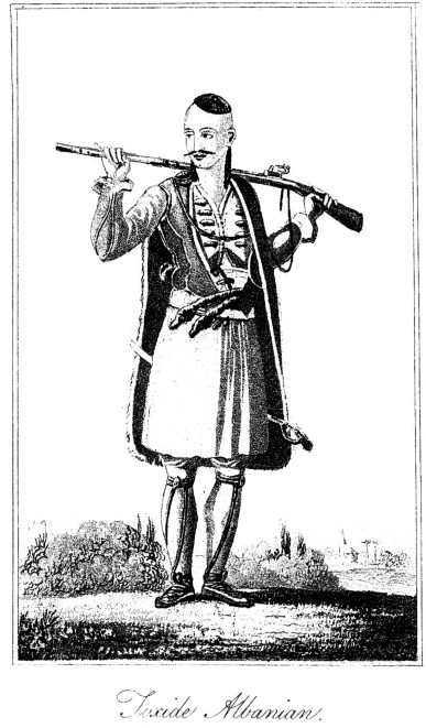
Having satisfied myself that the town has not succeeded to any place of note in antiquity, we proceeded on onr route for Tebelen, crossing the Aous at Premiti by a stone bridge of seven arches. Going down the right or north-east bank of the river for a league, on the side of Mertchika I saw two hamlets, Lippa and Bouali, placed on two eminences, just without musket-shot of one another, which, until Aly subdued both, were continually in warfare together. The melancholy solitude was now in some measure varied by the appearance of shepherds in arms and beys on horseback, tending their flocks and herds. We also encountered companies of the Toxide Albanians, whose bold martial mien brought to my mind what we are told of the ancient Macedonians; and these Toxides seem to want only another Pyrrhus, another Scanderbeg, to restore their former military character. Two leagues and a half north-north-west from Premiti, on our right, we began, to discover some of the villages of the district of Dagli, and about an hour afterwards, in attempting to ford the Liocnitza, our horses, beyond their depth, were thrown down, and riders and baggage all plunged in the water, from which we escaped with oftly a thorough wetting no great misfortune in the excessive heat which then beset us in the valley. After some time the Aous changed its course from north to north-west, and we came in front df a spacious valley which extended north among the mountains. This valley contains the road to Berat, on the Argent or Apsus. At the beginning of this valley the Aous penetrates to the westward, between gloomy impending precipices of great elevation, where the stream is scarcely to be seen. The place where the four vallies met was in abundant cultivation, whilst the surrounding mountains presented scenes of deep forest or naked pinnacles of the most picturesque contrast, scenes worthy of the pencil of a Titian or a Salvator Rosa. We came at last to a bridge over the Desnitza, the river which comes
![]()
58
down from Bousi, distant six leagues up the valley leading over to Berat. At this bridge ends the territory of Premiti, and begins that of Desnitza.
Having crossed the river Desnitza, I found myself opposite to the bridge of Melchiova on theVoioussa, at the entrance of the celebrated narrow pass or strait, or Stenon, a Greek term which ihe Albanians have translated into Grouca. On the left or south bank of the Voioussa rose up a range of mountains, styled by Livy and Ptolemy Æropus, in later times Meropa, and now Mertchika. On the opposite right or north bank extended the extremity of Asnaus, now called Trebechina. In the account of the expedition of the Romans under Flamininus against Philip of Macedon, we are told by Livy (xxxiii. 6.) that "Athenagoras was sent by Philip across Epirus into Chaonia, to occupy the narrow passes at Antigonia, called by the Greeks Stena. Philip himself, some days afterwards, following with the body of the army, explored the country, and conceived the Stena to be a fit position for him to make a stand. For there the Aous, flowing in a narrow valley between two mountains, the Æropus on the one side, and the Asnaus on the other, furnishes but a very confined path on one of its banks. The Asnaus Athenagoras was ordered to occupy, with his light troops: on Æropus the king himself was posted."
No sooner did I approach and enter this strait than I began to have an idea of the events recorded by the historians: I felt that I should now be able to supply some deficiencies in their relations. Before me, at the entrance of the strait on the right bank of the Aous, was situated Kleisoura, a place mentioned by some Byzantine writers, the capital of the district of Desnitza.
Advancing therefore, I entered the Grouca, the strait leading down towards Tebelen. The mountains on each side have really the appearance of having been torn asunder, to make way for the body of waters collected in the bosom of the Aous; just as Olympus and Ossa, in Thessaly, may have been separated to form Tempe, and open an issue for the Peneus. But the issue of the Aous is no Tempe. No murmuring brooks, no refreshing shades, no groves the resort of the nymphs, are found in the Grouca. Gloomy and forbidding, this strait is formed by the rugged sides of two parallel mountains, which afford between their bases a space, where the broadest not more than 130 yards wide, almost wholly occupied by the river. We proceeded down the right or north bank, along a narrow path, embarrassed by blocks of rook rolled down from Mount Trebechina on our right; and when
![]()
59
Straits of the Aous.
we had advanced a short way into the strait I observed the issue of a subterraneous stream, which was lost in the Aous. A hundred yards farther on was another stream, which broke out from a cavern of great depth. The bluish waters of this stream, called by the Greek inhabitants catachthonia matia (subterrene springs) issue with such force as to propel those of the Aous, and to make their visible way into the middle of the river. When we had advanced about 850 yards within the strait, on looking upwards I observed one of the bastions of the castle or fortress of Kleisoura; a fortress which even without artillery might prevent all passage through, by rolling down blocks of stone on an enemy, rash enough to attempt to penetrate, without being master of the heights. The Aous now sinks so deep in its bed, that the tops of the lofty planes on the brink of the stream scarcely arrive so high as the very confined path on which we travelled. Three quarters of a league below the bridge of Melchiova, at the commencement of the strait, we came to the bridge of Mitchioiou, both of them of Roman workmanship, where the valley widens a little. On the south side are several cascades, and lower down issues another underground river. Sixty yards below the latter bridge we come to the tchiftlik, or farming establishment of Gruca, where we halted to dine on the provisions we had brought with us.
Here it may be necessary to mention that, in the Albanian tongue, gruca corresponds to the Greek trachis, a strait or narrow pass. Kleisoura was applied, under the lower empire, to villages or fortified posts, situated at the entrance, or rather at the narrowest point of stena or strait passes. While seated under a spreading walnut-tree, we were visited by some of the people of the tchiftlik, remains of the unfortunate inhabitants of Gladista, in the country of Souli, who, after the complete subjection of their nation to Aly, had been transported to this dreary and inhospitable region. Heart-rending were the complaints of these ill-fated people; nor could their lamentations and even execrations be restrained by the presence of Aly's people in my company. On my return to Janina, I ventured to submit to Aly a brief representation of the miserable situation of the Souliotes of Gruca. "Let them perish," was his answer; "it was not for the purpose of living at all that I sent them thither."
Proceeding on our route, after I had bestowed a trifle on the deplorable Souliotes, we passed some substantial massy walls, which the Albanians said were the remains of a monastery, built by the French, not by the Franks in general; for they insisted on the term Frances, not Freng. Opposite
![]()
60
to this spot the Aous took a bend to the south, and the breadth of the valley might there be half a mile. Nearly three miles below Gruca we traversed the ruins of a town now called Chamoli, but its ancient name is unknown. The objects of antiquarian research seemed to be confined to foundations of buildings, and a kind of aqueduct to convey water from the neighbouring hills. Here the Aous bears so close under the high ground on its north bank as to leave only a dangerous path for half a league on to Dracoti, a large village which shuts in the western extremity of the Gruca or strait of the Aous. The houses I remarked to be all furnished with battlements and loop-boles, and inclosed by trees. The inhabitants, who came to their doors to see our caravan as we passed, seemed to be the stoutest and the handsomest of all the Toxide Albanians whom I had seen, and among whom they glory in being reckoned. Their bold air and mien, their gestures and equipment, justified the high reputation for courage and valour they have acquired in the country, and even among the Toxide tribes themselves. Among the men, numbers showed by the scars on their weather-beaten visages, that they had been in close quarters with their foes. Such warriors are called in Albanese boûre, and in modern Greek palicari. Going out of Dracoti we crossed a spacious burying-ground, and saw half a league off, beyond the river, Codras or Codrion, a village inhabited by Christians, originally removed from Caulonias, or the Candavian mountains.
The great range of Mertchika, which along the strait takes the name of Melchiovo, behind Codras, is termed Palesia; and the Trebechina, or the Omitchioto, on the north bank of the Aous, falling off northward, takes the name of Maile-Dam, or the mountain of Damesi. Near Codras the Aous receives a small river, and a little lower down the Celydnus, or the stream which flows from south to north along the valley of Drynopolis, or Argyro-castron. From Dracoti we employed three quarters of an hour in descending the north bank of the Aous until we came in front of Tebelen, already mentioned in Chap. IV. The bridge over the Aous had lost two of its arches by the violence of the current, which, now much augmented by the accession of the Celydnus, bends northward. We had therefore to wait for the bark aground on the opposite bank, a confined square raft rather than a boat, without oars, and managed only by a pole. In this wretched machine we embarked with our baggage; whilst our cattle swam across fastened to the machine, and to one another. Pushing off from the bank we gained the course of the stream, deep and rapid, which hurried us down a great way to a place where we
![]()
61
Description of Tebelen.
ran aground on the opposite shore, where we landed, and I proceeded to the palace of Aly, in Tebelen, where, by his orders, I was lodged and entertained by his steward, with all the cordiality which could be manifested to a Christian by a Mahometan.
Tebelen is said to occupy the position of Titopolis: but in my opinion
it is wholly a modern town, which owes its importance to its having been
the birth-place of Aly of Janina. The houses inhabited by Turks, the peculiar
favourites of Aly; the seraglio or palace placed in a magnificent position;
all announce the residence of the modern master of Epirus and of his assassins,
the instruments and the partners of his fortunate crimes. The palace, covering
a vast space, contains a saloon of extravagant dimensions, surrounded within
by sofas covered with rich brocade, the manufacture of Lyons, in France,
and the ceiling supported by columns, erected around a square bason lined
with white marble, having in the midst a number of jets-d'eau. This saloon,
with the apartment allotted for my use, was the only part of the palace
then fit for occupation: all the other halls and chambers were either rebuilding
or repairing. Arches were also constructing over the cellars and subterraneous
store-rooms in which Aly deposited his money, heaped up, as he says, against
the days of old age, without once reflecting that age which has already
bleached his beard, already bends him toward the grave. But as the idea
of his approaching end fills him with horror, he employs every artifice
to hide the course of time from his imagination. Of Tebelen Aly speaks
with delight, and to me he had described it as a second paradise. But for
my part I could see nothing but a gloomy valley, bounded by mountains naked
and forbidding; the birth-place of storms and tempests, which rage with
such fury that it has never been possible to raise a tree round the place.
The
palace has the repulsive air of a prison. When the day declines the gates
are closed and barricaded: armed guards repair to their assigned posts;
dogs of the famed Molossian breed, turned loose in the courts, make the
air resound with their bowlings. [*] I was myself, in
fact, im-
*. The Molossian dogs, the companions of the Meliboeus and the Menalcas of antiquity, are the trusty guardians of the flocks which encamp in the open air all the year round. The vigilant care of these animals is not more remarkable than their furious ferocity. Hence are they the terror, not of the peaceful traveller alone, but of the nightly wolf and the robber. The Molossian race are distinguished among all the dogs of Epirus, Albania, and Dalmalia. They are known by their extraordinary size, by their pointed muzzle, and by their long while hair, a defence equally against rain and
![]()
62
mured in a chamber without windows, with my servants; and an Albanian slept on the outside of the door, with an order to accompany any of us who should desire to go out. In the abode of tyranny every thing is a cause of suspicion. Many times, during the long nights I passed in that place, did I hear the clanking of the chains of the miserable beings, groaning in the dungeons sunk, as well as the vaulted receptacles of Aly's treasures, in the solid rock, under the magnificently furnished apartments prepared for his accommodation. In the mountains, on the south and west of Tebelen, even with an escort, I could make no considerable excursions: for the Japorians of the eastern districts of Acroceraunia were not then fully subdued to the rod of Aly.
From the best observations, however, which I could make on the surrounding summits, as well as from what I believed to be faithful information, Tebelen seemed to be situated at the vertex of a triangle, of which Valona and Berat, each distant twelve leagues, occupied the other angles. In front of Tebelen, toward the north-east, I observed the opening of the defile across the range of Trebechina, which communicates with Berat and Cleisoura, without piercing through the great strait of the Aous by Gruca. In the opening mentioned is situated Damesi, a fortress noticed in the time of the lower empire. This communication across Mount Trebechina to Cleisoura is of importance, because it fully explains the operation of Flamininus, when by a secret, or at least an unsuspected path, he sent on a detachment, which, turning Philip's position on the Aous, compelled him to retreat.
Having, on my route from Port Palermo to Janina, traversed the southern
or upper part of the course and valley of the Celydnus, I availed myself
of my visit to Tebelen to survey the whole course of that river, from its
influx into the Aous, three miles above that town, to Argyro-Castron, then
still independent of Aly; but I had friencls in the place, and there-
cold. The Molossian grey-hounds differ from those of the west of Europe by their superior fleetness, and by a tuft of hair at the extremity of the tail.
Dogs of the Molossian and the Spartan kinds are particularly recommended by Virgil to the attention of the husbandman.
"Nor least of all thy cares the faithful hound,
The Spartan swift, or the Molossian fierce.
Feed them with strengthening whey; guarded by them
Nor nightly wolf, nor robber, need'st thou fear,
Nor unsubdued Iberian's dark assault."Georg. III. 404.
fore thought my journey thither might be accomplished without danger. In quitting Tebelen, I employed myself, but without success, to discover in its vicinity some trace of the existence of a town supposed to hare existed in the Fauces Antigoniæ placed in that quarter. When, however, I had advanced a mile from Tebelen, near some springs issuing from the roots of Mount Argenik, my attention was called to certain terraces or banks and ditches, which, by their distribution, seemed to indicate the encampment of Flamininus. Two miles farther on, I came to the junction of the Celydnus, or the river of Drynopolis with the Aous. Travelling for three miles up the left or west bank of the Celydnus, in a very fine morning, the valley displayed itself with singular beauty, and the more so that I then arrived from the dreary valley of Tebelen. At the end of three hours' delightful ride, we entered what is properly the valley of the Argyrians, now of Drynopolis; and to have time to make my remarks, I proposed to shelter ourselves from the powerful sun, under a cluster of planes near the bridge of the Soubashi, a league on the outside of the Fauces Antigoniæ, or the defile of Cormovo, a place of note in the history of the internal warfare of Epirus. To the proposed halt my vigorous and active Albanians, but who like all the orientals delight in repose, readily acceded. While at breakfast, I opened my project of going to Argyro-Castro, a project which it required my utmost power to engage my conductors to adopt. To visit a town not subject but hostile to Aly; a town in which the different parties were actually in arms the one against the other, seemed to be an act of insanity. Showing, however, a recommendatory letter for Mourtaza-bey, one of the most powerful leaders, I despatched one of our postilions with it, and to advertise that chief that, without waiting for his answer, I meant to be with him before sunset. Remaining in the same place till three in the afternoon, we set forward for Argyro-Castro. When we reached some springs which break out from the rocks under that town, we found a party of Albanian soldiers dressed in jackets of velvet, embroidered with gold and completely armed, sent down by Mourtaza-bey to escort me to his house. The opposing parties in the town being then in open war, one of the escort passed on before me, to acquaint the several chiefs of my approach; and the firing ceased, not only during our passage through the town, but for the whole of the day. Mourtaza I found entrenched with his vassals in his castle, armed from top to toe, like the warriors of days of yore. The Greek bishop, who had been invited to meet me, did the honours of the house; for, as the worthy bey said, " Such a person was fitter to enter-
![]()
64
tain me than an Albanian, who had never seen any thing but his native mountains." When Mourtaza had performed his prescribed evening devotions we went to supper, where I remarked, that, although a Turk, he from natural politeness yielded the post of honour to the Christian bishop, for whom he entertained genuine respect and regard. The supper was splendid for variety of dishes and of wines, of which Mourtaza made no scruple to shave freely; and the conversation was equally agreeable and instructive. Had our host been bred in the most polished society, he could not have more gracefully mingled dignity with complaisance. The country called Dryopia of ancient Greece, I had endeavoured to discover in various quarters of Epirus; but always without success. Pliny having placed it in the vicinity of the Sellians of Dodona, I was led to look for Dryopia in the valley of Drynopolis, of which I had observed the remains on the east side of the Celydnus, on my way to Argyro-Castro, two leagues from that town. Argyro-Castro, which I found distracted with sanguinary and endless contentions, is situated on three spurs from the mountains on the west, ending abruptly over the valley of the Celydnus on the east. These precipitous promontories are separated by deep gullies hollowed out by torrents. On these rugged summits are erected the houses, some even adhering to the precipices like swallows' nests. Solidly built of stone, the dwellings are pierced with loopholes, and, according to the wealth of the masters, inclosed within embattled walls flanked by towers. The more difficult of access, the more a house is valued. Bridges are thrown over the ravines for communication; others to support some projecting part of a building. The strange assemblage of towers, extravagant edifices, houses suspended in the air, or on the edges of rocks and precipices, well accorded with the state of hostilities in which the people live. "How is it possible," said I to myself, "that human beings should be so devoid of relish for enjoyment, as to choose for their habitation a spot destitute of all vegetation, on a soil calcined by the action of the sun, and exposed to the contradictory fury of the elements?" But I recollected, that where no law but that of brutal force exists, a regard to self-preservation is the governing principle among men. The principal houses have cisterns for collecting water, and in the town are a few fountains supplied by an aqueduct from the springs of Sopoti. I learned from the bey, that, on account of the natural strength of the town, it now contained a population of 2,000 Turkish families: but the bishop added, with deep concern, that in the varochi, or Christian quarter, now pushed down towards the bottom of
![]()
65
Antiquities of' Tebelen.
the valley, he reckoned only sixty families, in oppression and poverty. Such is the corner of the land now allowed to be occupied by Christians, in a cify founded by their progenitors, in consequence of Mahometan intolerance. The revenue of the bishop, once very considerable while the several flocks under his care were numerous and productive, do not now exceed 250 l.
In my walks in and about the town I could discover no vestiges of antiquity. I was assured, however, that formerly existed remains of a great church with columns, in the quarter called Colorsa, where, since 1813, when Aly became master of Argyro-Castro, he has constructed a palace of great extent. On that spot I found no vestiges whatever, but I found myself in a position most favourable for commanding the approaches to the town. From the same position I was able to determine the bearings of many towns and villages in the valley, which are always erected on eminences, on account of the moist aguish air of the plain. Proceeding on my journey along the hills on the west of the valley, in two hours I reached Gorandgi or Goranis, a village celebrated in the country for a cavern, described to be of vast extent, probably natural, but much altered by art. At the entrance on the side of a hill, I saw a capital of a column, but the base and shaft were gone; a few years before it was entire. By means of torches of resinous wood, we descended into the cavern by a sloping passage, leading to a sort of stair formed by steps cut in the rock, as far asunder as a man can stretch his leg. The roof seemed to be about twelve feet high, supported by pillars hewn out of the rock. This passage and stair ended at a body of water, which, as I was told, is so much diminished in the end of summer as to uncover eighty-six steps, a depth of 220 feet. At that depth are seen columns, a large stone table, and a subterraneous river, which afterwards breaks out on the mountain side near Argyro-Castro.
The breadth of the valley from Gorandgi, over the valley to Liboôvo, formerly seen on the road from Delvino, ios about four miles; and from the same place to the pass of Moursina, the distance is two leagues. In this space may be counted eight villages ranged along the side of the hills, separated by as many torrents, rushing down to the Celydnus. Continuing our route, we at last came to Grapsi, where we resumed the road formerly followed on my journey from the sea-coast to Janina, as described in chap. vi. of this work.
On the eastern side of the valley of the Celydnus, is situated Liboôvo, the second town of the district of Drynopolis, in an advantageous position in the midst of a fertile tract on the
![]()
66
side of Mount Mertchika. The town was among the earliest of Aly's conquests,
and there he built a palace on a large scale, now the usual residence of
his sister Chaïnitza, the haughty and relentless mistress of Dryopia.
In the town are reckoned 6,000 Albanians Mahometans, and some hundreds
of Greeks employed in various trades. Nearly a league to the northward
of Liboôvo is Liabovo, near the entrance of the valley of Socachos,
which conducts the traveller up to the northern level plain of Mertchika,
called Londgiaria, or the land of forests. This tract, which comprehends
the summit of Mount Æropus, on the south bank of the Aous in the
strait of Gruca, is bounded by the districts of Cleisoura, Premiti, and
Palaeo-Pagoni. In this tract, near the village Stepopolis, are to be seen
the ruins of an ancient town, now called Gionaksat, and the monastery Spileon,
founded and endowed by the emperor Alexis Comnenus. The inhabitants of
this tract are Albanian Christians, in number about 1,450 persons. In this
country exists an association of original Epirotes, who, from very remote
times, have in the eastern empire exercised the profession of souterazzi
or sottterazzici, or conductors of water; a term formed from two
Turkish words, sou water and terazzi equilibrium or level. This profession
belongs originally to the inhabitants of the classic regions of Greece
Proper. It appears, that, when the best days of Greece were at an end,
the people of Mount Æropus calculated and applied to a new system
of aqueducts, the law by which fluids in a confined tube or channel will
rise nearly to the level of their source. Their object was to substitute
for aqueducts supported in a horizontal position on arcades, others conducted
under-ground. According to the Albanian Christians of Londgiaria, to their
ancestors were the people of Nicopolis, the monument of the victory of
Actium, indebted for their aqueduct, partly above and partly below the
surface, whihi conveyed the waters of the springs of St. George, distant
fifteen leagues. They were also the conductors of the waters furnished
by Adrian, from the heights of Stymphale to Corinth, and of the aqueducts
of Constantinople. Whatever may be thought of these claims, certain it
is that, of all the incorporated bodies of artificers established in the
Greek empire, the water-conductors perhaps alone were maintained by the
Turks; and that they still continue, from father to son, to exercise the
same profession in the capital and other principal towns of Turkey. Various
modern works attest the skill of the Londgiarians, among which is the aqueduct
on arcades in Santa Maura, construcled while the Turks were in possession
of that island, the aqueducts of Janina, Elbassan, Tebelen, Argyro-Castro,
&c.
[Previous] [Next]
[Back to Index]